Accurate Navigation Without GPS

Circuit keeps up to 5.5-meter accuracy after 3 kilometers
The global positioning system can locate you within 5 to 10 meters anywhere on Earth—as long as your receiver is in the line of sight of multiple satellites.
Getting location information indoors is tricky. A team at the University of Utah has now put the solution underfoot: A suite of sensors and circuits mounted to a boot can determine position with an accuracy of about 5 meters, indoors or out, without GPS. The navigation system, installed in a very hefty prototype boot, could help rescue workers navigate inside buildings, and show firefighters where their team members are.
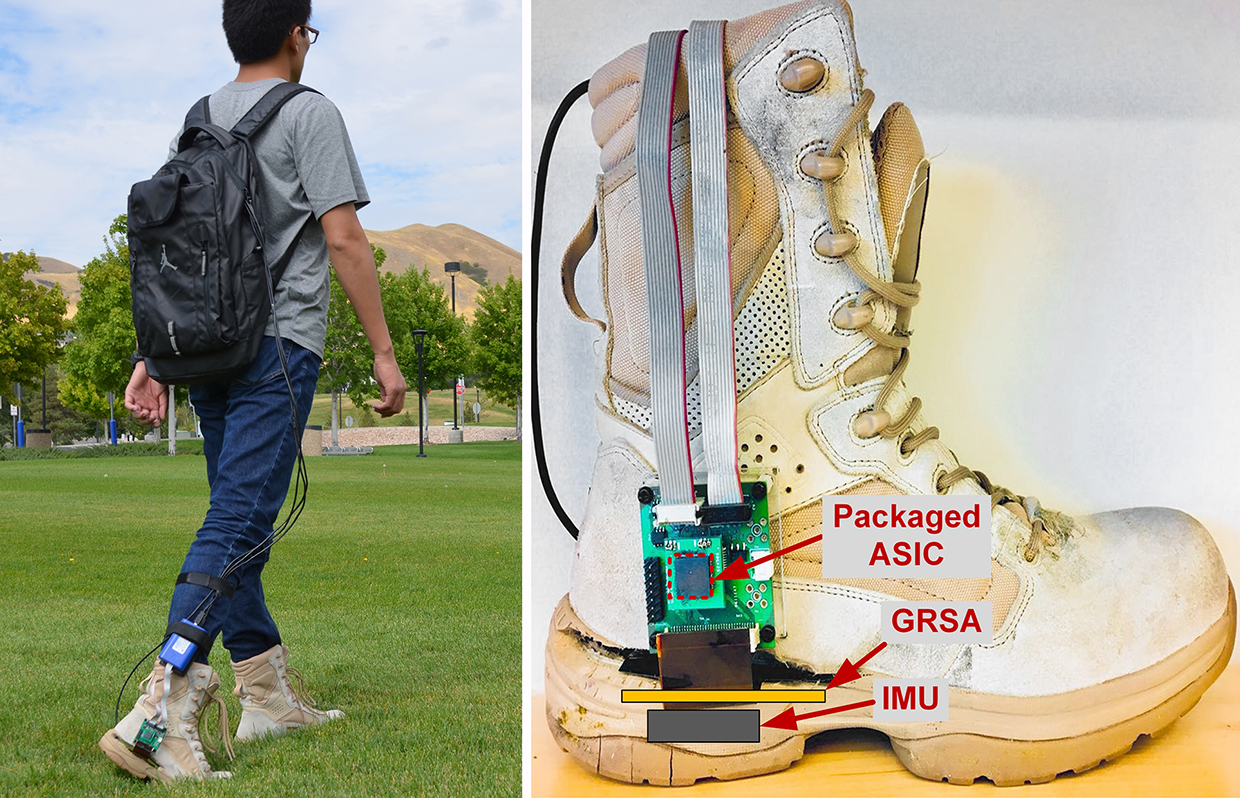
It might also be integrated with virtual or augmented reality games. The Utah researchers presented their GPS-free navigation system on Tuesday at the International Solid-State Circuits Conference in San Francisco. The Utah group’s navigation system is built on an inertial measurement unit or IMU—a little black box containing a gyroscope, magnetometer, and accelerometer.
High-end systems of this kind help airplane pilots navigate. Darrin Young, an electrical engineer at the University of Utah, wanted to make it possible to use an IMU in portable electronics. But readings from cheap versions of these sensors drift over time, and errors can accumulate rapidly.
“If you’re sitting still the reading should be zero,” says Young. But after five or ten minutes sitting in a chair, the low-end IMU might think you have moved a few hundred feet away.
Young asked graduate student Qingbo Guo to figure out a way to keep these sensors calibrated. Guo found the solution in biomechanics.
During each step, the heel is anchored to the ground for about 100 milliseconds. Guo figured out how to measure this instant of stillness, and use that to correct for the false motion in drifting data from the IMU. “You reset the position calculation with every step, so you do not accumulate error,” says Young.
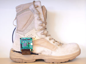
Guo designed a flexible MEMS pressure sensor to place under the insole of a boot with an IMU. He calculated that the system needed about 1000 sensors to get accurate readings (and provide redundancy in case some sensors broke underfoot), and built a custom circuit to combine data from the IMU and the pressure sensors, and designed the necessary algorithms. In the prototype, the custom circuit is on a printed circuit board mounted to the side of the boot. “We put it outside the boot for easy access and debugging,” says Guo.
“But it could be inside the sole, and use Bluetooth.”
Then he connected it all up with cables to a laptop in his backpack, and started walking.
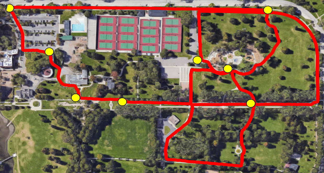
To test the navigation system, Guo walked in Salt Lake City for about three kilometers with the navigational boot tracker, then compared data from the prototype with GPS data. After ten walks around campus, the maximum error was about 5.5 meters. He also tested the system during a longer walk in San Francisco’s Golden Gate Park.
It doesn’t matter what kind of terrain, the system works. “The performance is comparable to GPS, but it works inside,” he says.
Add new comment